3D landscape data visualisation in Blender – 14 October
Skills course 3D landscape data visualisation in Blender
Date: 14 October 2021
Location: online
Credits: 1 EC
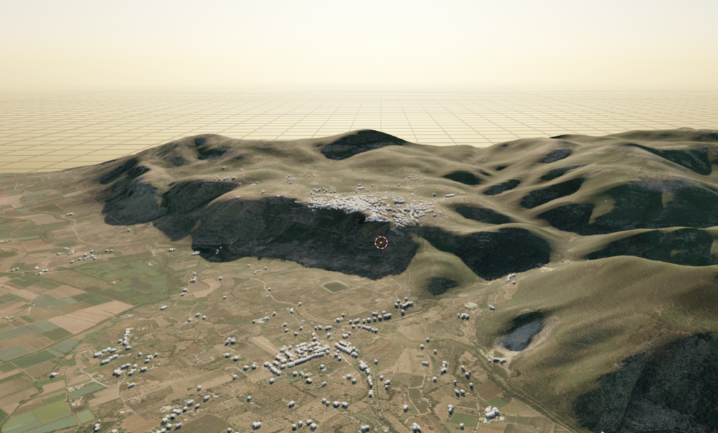
In archaeology, landscape data visualisation is usually done in GIS packages such as ArcGIS and QGIS. These are very powerful toolboxes but have their limitations, for instance when it comes to 3D data, real time feedback, rendering and animation. 3D modelling software forms a different approach to data visualisation. It allows for more interactive data exploration with immediate visual feedback and offers possibilities for attractive presentation, including animation. In this workshop you will learn how to work with GIS data formats in open source 3D modelling software Blender and take advantage of the possibilities this program has to offer.
Participants are advised to install the software before the workshop starts (https://www.blender.org/download/) and to use a laptop/computer with a mouse.
Program:
Online introduction to the course about landscape data visualisation backgrounds by Tijm Lanjouw. GIS software versus 3D modelling software will be discussed. During the introduction will be explained how to use the video tutorials and where to download the workshop data.
9:30-10:00 introduction
10:00-12:15 video-based self-study and assignments
12:15-12:30 questions/discussion
12:30-13:15 lunch break
13:15-15:00 video-based self-study and assignments
15:00-15:15 break
15:15-16:30 video-based self-study and assignments
16:30-16:45 questions/discussion
Teacher is available for answering questions throughout the entire session. Important issues are discussed centrally in the question segments.
Videos:
- 3D modelling, basic concepts: what are digital 3D models, how do you make them, which data formats do we use, what are shaders, what is rendering.
- Blender, basic usage of the software: interface, adding objects, importing, edit/object modes, visualisation/render modes, creating and adjusting lights, modify material/colour.
- The Blender GIS plugin, basic usage: how to install it, what data formats does it support, how to import GIS data, how to turn a DEM into a 3D model, how to use the DEM analysis tools.
- Create different lighting and colour setups, adjust camera settings, and make renders (still pictures) of the result.
- How to make an animation? Basic concepts (mainly: keyframing and how to use it). Animate lights, materials, and camera. Render animation and export.
At the end of the course there will be time for individual questions and special requests.
Registration: Fill in the registration form below. There will be a maximum of 15 participants, so ARCHON members have priority. Note: We reached the maximum amount of participants!
